Delving into the wonders of satellite imagery reveals a domain where cutting-edge technology intersects with data-gathering practices. These visuals provide information spanning from climate shifts to city growth patterns. Comprehending the mechanisms driving this process grants insight into the methods of image acquisition and application.
Exploring the World of Satellite Imaging
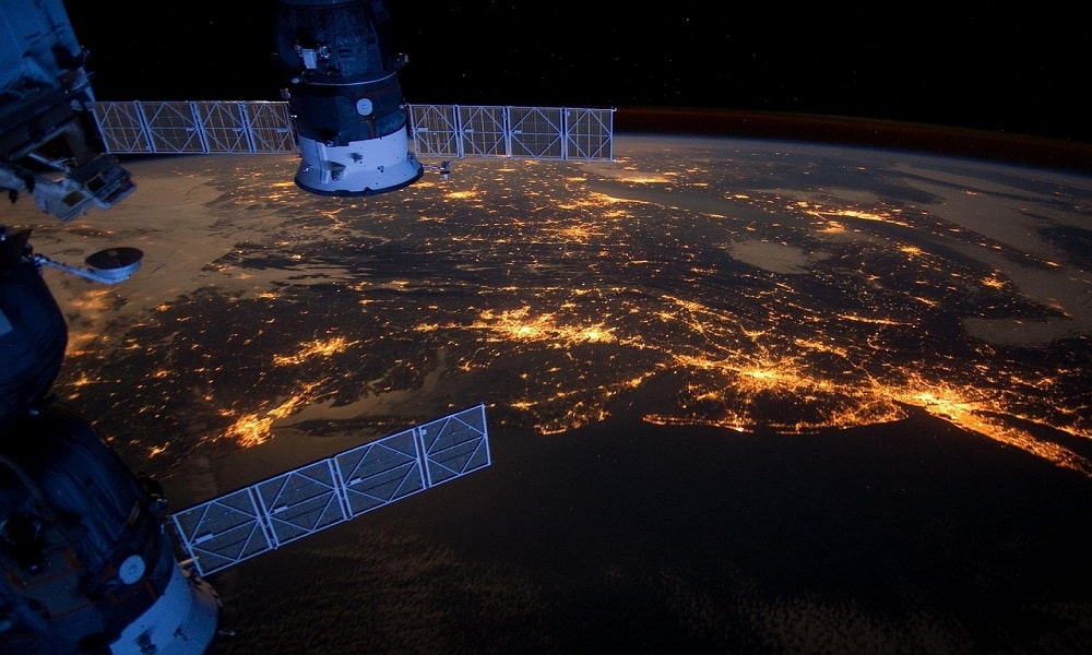
Observation of our planet from space through satellite imaging entails capturing photographs of the Earth’s surface using sensors installed on satellites, which relay the data to ground stations for analysis and interpretation. This satellite imagery of Earth aids in tracking alterations in the environment and urban development planning, as well as forecasting calamities. By scrutinizing aquatic environments from above, the scientific community gains a more comprehensive understanding of global occurrences.
The Function of Sensor Technology
Satellite imagery relies heavily on sensors to capture data from the Earth’s surface by detecting and recording radiation reflections or emissions in various forms. These include optical sensors, which function like digital cameras to capture visible light and produce high-resolution images, and radar sensors that use microwaves to penetrate clouds and work in low-light conditions. Infrared sensors are also used to detect heat levels and gather essential information on temperature variations and vegetation health.
Geostationary Satellites vs. Polar Orbiting Satellites
There are two main types of satellites that capture images: geostationary and polar-orbiting satellites. Geostationary satellites stay over one spot on Earth’s surface, moving at the same speed as the planet’s rotation. This allows them to monitor the same area continuously, which is excellent for weather observation. In contrast, polar-orbiting satellites zip from north to south, flying over both poles. Their orbit allows them to capture images of the Earth’s surface with each pass.
Managing Data
After data is obtained, it is processed before being transmitted to ground stations for analysis and refinement. Signals are sent from the satellite to a network of ground stations, where the raw data is processed to create images by correcting distortions and enhancing clarity as needed. These images are then utilized in various applications, including research and commercial mapping projects.
Uses of Satellite Images
Satellite imagery is useful in several areas, such as science, where it helps monitor deforestation trends, track glacier movements, and observe changes in biodiversity levels. Urban planners use satellite data to design eco-cities, study traffic flow patterns, and evaluate infrastructure needs. Additionally, meteorologists rely on satellite images to predict weather conditions and anticipate weather events.
Advancements in Technology
Technological advancements continue to improve the capabilities of satellite imagery by introducing higher-resolution sensors that capture more detailed images, thereby enhancing the accuracy of analysis. These innovations also enable faster data processing speeds, allowing for near-real-time monitoring of Earth’s surface. Moreover, CubeSat technology has made collecting satellite images more cost-effective and accessible to a broader audience.
Obstacles Encountered in Satellite Imaging
While satellite imaging has made significant progress, challenges still remain. Cloud cover can block sensors, affecting their functionality. Radar and infrared sensors offer some automation solutions to address this issue, although they also have their own limitations. Additionally, the large volume of data generated requires significant storage and processing capabilities, which can create logistical hurdles.
Ethical Concerns
Observing Earth from space is a privilege that carries the responsibility to handle satellite imagery ethically, especially when it comes to privacy issues stemming from high-resolution images capturing personal activities. Balancing transparency with privacy concerns poses a dilemma for entities leveraging this technology. Clear guidelines are essential to ensure that satellite imagery is used in ways that contribute to society’s well-being while safeguarding the rights of individuals.
Looking Ahead
The outlook for satellite imagery appears bright as new technologies are poised to transform data-gathering practices. The integration of artificial intelligence and machine learning into image processing facilitates more accurate analyses. Upgraded satellite designs and launch mechanisms are continuously broadening the availability of high-quality images. As technology progresses, satellite imagery is expected to become even more crucial in understanding the complex systems of our planet.
Closing Thoughts
Satellite images provide valuable information about the changing features of Earth’s surface and environment. The technological tools used in this field, such as sensors and data processing methods, contribute to the acquisition of up-to-date data. Despite facing obstacles, ongoing progress in satellite imaging holds the promise of groundbreaking ideas and findings. As people increasingly adopt these technologies, satellite imagery will continue to be a powerful tool for understanding and overseeing global affairs.